


 9 / 34

ACT Autonomous Surface Vehicle Workshop Report
Page
9
of
34
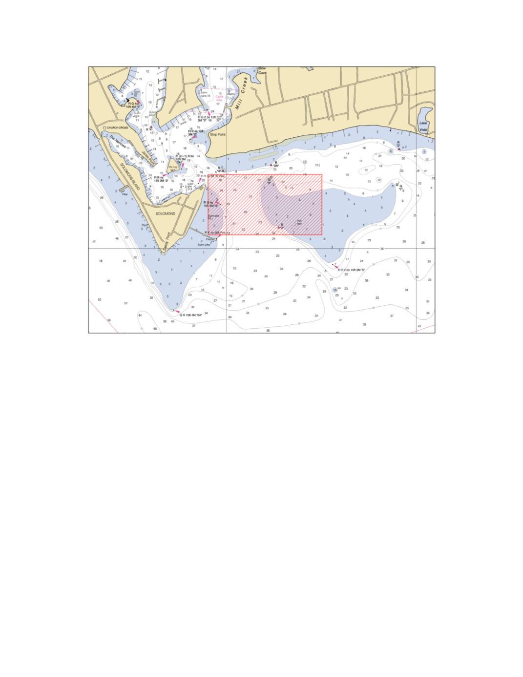
Figure 1. Approach Channel and associated shoals to Solomons, MD. The red zone designates
the ASV Workshop demonstration survey area.
As an example, the ASV demonstrated by Woods Hole Oceanographic Institution provided the
vehicle tracks and multi-beam sonar coverage swaths shown in Figure 2 and the gridded and
interpolated bathymetry shown in Figure 3 respectively.
For comparison NOAA provided
images shown in Figure 4 of the 1944 survey H6876 (top), and
the current navigation chart (bottom). As one can see, virtually all the soundings in the test
area come from this WWII era sounding-pole survey. In most shoal areas the charted depths
drop to as little as 1 ft., making survey by conventional manned launches and autonomous
surveys difficult to plan as the uncertainty in depth would not allow even most shallow draft
autonomous vessels to operate in this region. The new measurements reveal most of these
areas were 1 m or deeper, allowing operation of survey vessels. This is not to say that this chart
has not been periodically updated producing a useable and safe product, albeit based on very
old data.