Basic HTML Version


ACT Protocols for Wave Measurement Systems
July 2012
17
For a similar comparison in shallow water, the 15 sensor pressure array located at U.S .Army
Corps of Engineering Field Research Facility (FRF) in Duck North Carolina will serve as the
verification standard. As specified by the FRF, wind wave frequency-direction spectra are
obtained from the nine-element linear array of bottom mounted pressure gauges located on the 8-
m contour about 900 m offshore of the FRF. Directions depicted in frequency-direction spectra
from the FRF 8-m array represent azimuths from which waves arrive in degrees
counterclockwise from normal to the array, or from parallel to the FRF pier, or, approximately,
from shore normal. Zero degrees represents waves propagating straight onshore, having
wavenumber vectors aligned with the pier, and wave crests perpendicular to the pier. A direction
of +45 degrees indicates waves coming from the northeastward side of the pier, and propagating
along an azimuth 45 degrees to the left of the pier axis for an observer looking seaward. An
angle of +90 degrees represents the (rather uncommon) condition of waves propagating straight
down the coast from north to south. Negative angles represent waves from the southeastward
side of the pier. Waves at -45 degrees propagate onshore and northward along an azimuth 45
degrees to the right of the pier axis for an observer looking seaward.
All results are based on 8192-sec (2 hr 16 min 32 sec) time series of data collected at 2 Hz or,
rarely, 4 Hz. The basic analysis algorithm is the iterative maximum likelihood estimator derived
as described by Pawka (1983), using his recommended convergence parameters and a maximum
of 30 iterations. A description of the FRF linear array is given by Long and Oltman-Shay (1991),
and details of data analysis are given by Long and Atmadja (1994).
10.0 Field Study Location and Deployment
10.1 West Coast, Deep Water Waves (Task 2)
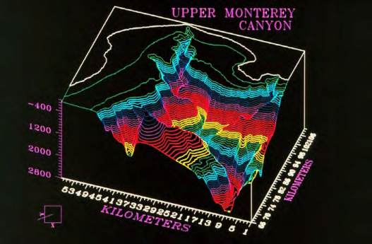
In situ evaluations of wave measurement systems performance in deep water, moored,
application will be conducted in Monterey Bay, CA. This location was chosen to capture the
long period, energetic waves typical of the west coast environment. It was noted that the
complicated bathymetry of the Monterey Canyon causes large, longshore, spatial variations in
shallow water waves making this a poor choice for a co-located shallow water wave test and
evaluation. The depth at the proposed deep water location (36.753N, 122.423W) in the Canyon
is 2115 meters. As stated previously, NDBC and JCOMM are both deploying directional wave
sensing buoys at this location for a co-
located inter-comparison. NDBC
46042 (3-m discus buoy), MBM2
(NDBC 46093), and a Scripps Datawell
Waverider (NDBC 46236) are currently
positioned in the Canyon.
ACT would take advantage of these
existing tests and operations by using
the NDBC/JCOMM deployed Datawell
Waverider for its standard and
deploying the participating
manufacturers’ instrumentation near,